


MapPad pomiar powierzchni GPS

Opis MapPad pomiar powierzchni GPS
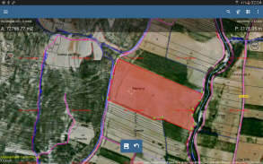
Użyj MapPad do obliczania obszarów, obwodów i odległości oraz zapisywania, eksportowania lub udostępniania pomiarów.
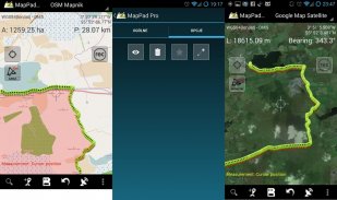
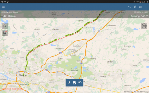
MapPad zapewnia wielofunkcyjne rozwiązanie do mapowania, które umożliwia przechwytywanie lokalizacji oraz określa odległość i obszar dla kształtów narysowanych na mapie lub uchwyconych przy użyciu śledzenia GPS w czasie rzeczywistym.
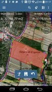
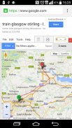
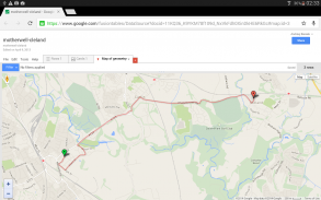
Natychmiast obliczyć pole pola lub odległość spaceru, korzystając z widoku satelitarnego Google lub Bing Map. Oszczędzaj benzynę i czas oraz rejestruj funkcje za pomocą kilku kliknięć na mapie.
Dzięki MapPad możesz łatwo przechwytywać, zarządzać i udostępniać swoje dane.
MapPad to bardzo przydatne narzędzie dla każdego, kto zajmuje się leśnictwem, rolnictwem, inżynierią i zarządzaniem nieruchomościami.
Odwiedź naszą stronę internetową, aby dowiedzieć się, jak przygotować mapę offline i uzyskać więcej informacji o tym produkcie.
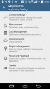
Wybrane funkcje:
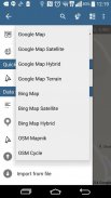
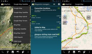
- Mapy podstawowe: Google Maps, Open Street Map, Bing Maps
- Nakładki na Mapy Google (niestandardowa usługa kafelkowa WMS lub ArcGIS Server), niektóre warstwy, takie jak mapa topograficzna USA, zostały wstępnie zdefiniowane.
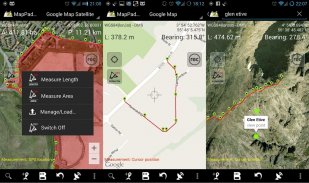
- Bardzo dokładny pomiar obszarów i odległości.
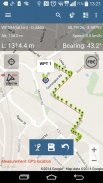
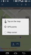
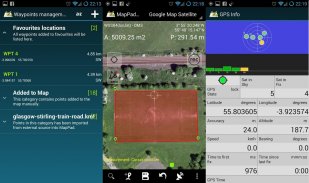
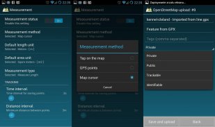
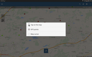
- Obsługiwane są 3 metody pomiaru (dotknij mapy, lokalizacji GPS, lokalizacji kursora mapy).
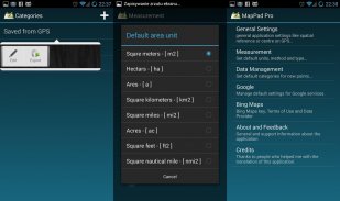
- Wsparcie dla liczby jednostek metrycznych i imperialnych.
- Wsparcie dla kilku globalnych i lokalnych układów współrzędnych, jeśli potrzebujesz wsparcia dla jakiegokolwiek innego odniesienia przestrzennego, skontaktuj się z nami.
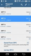
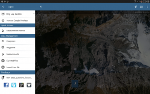
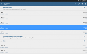
- Możliwość przechwytywania punktów trasy i grupowania ich w kategorie.
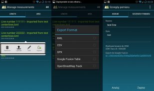
- Możliwość dodania lub edycji tytułu i opisu dla każdego zarejestrowanego pomiaru i punktu trasy.
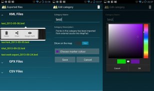
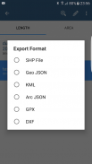
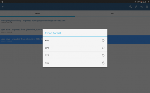
- Eksportuj pojedyncze lub wielokrotne pomiary lub punkty do pliku SHP, Geojson, ArcGIS Json, KML, GPX, CSV i DXF na kartę SD lub usługi w chmurze, a także bezpośredni eksport do Open Street Map.
- Udostępniaj lokalizację pojedynczego punktu bezpośrednio przez SMS, e-mail lub w inny sposób.
- Profil wysokości dostępny dla pomiarów wykonanych przez GPS.
- Import plików KML i GPX do aplikacji.
- Status GPS i status satelitów.
- Adres, wyszukiwanie lokalizacji.
- Szybkie otwieranie wyeksportowanych plików KML w Google Earth
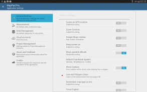
- Możliwość ustawienia domyślnych jednostek miary, kolorów kategorii punktów trasy, czasu rejestracji śladu i interwału odległości, przezroczystości nakładek Map Google i wielu innych ...
Nasi użytkownicy z powodzeniem korzystają z MapPad w wielu projektach i aplikacjach.
MapPad pomiar powierzchni GPS - Wersja 7.5.0
(19-05-2019)
MapPad pomiar powierzchni GPS - Informacje APK
Wersja APK: 7.5.0Pakiet: com.osedok.mappadNajnowsza wersja MapPad pomiar powierzchni GPS
Inne wersje


Apki w tej samej kategorii
Mogą Cię się spodobać...
 4.074.44.414.574.09


